|
Home
Word
of the Day
Archives
Clever
Clue of the Month
The
Cruciverbalist
Links
Daily
Email
|
|
OUSE
(ooz)
1.
River Ouse: a river of North Yorkshire, England
2. Great Ouse:
largest and longest of several United Kingdom rivers bearing this
name
3. River Ouse: river in the counties of West and East
Sussex in England
Common
clues: Yorkshire river; York's river; Any one of three English
rivers; River to the Wash; English river to the Trent;
Northamptonshire river
Crossword
puzzle frequency:
once a year
Frequency
in English language:
26418 / 86800
Video: A
Boat Trip on the River Ouse, York
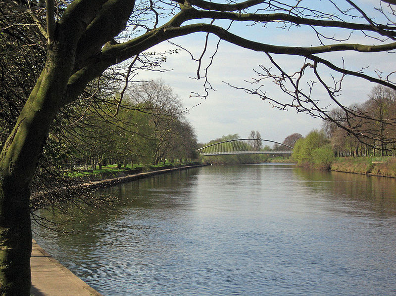
The
River Ouse is a river in North Yorkshire, England. The river is
formed from the River Ure at Cuddy Shaw Reach near
Linton-on-Ouse, about 6 miles downstream of the confluence of the
River Swale with the River Ure. It then flows through the city of
York and the towns of Selby and Goole before joining with the
River Trent at Trent Falls, near the village of Faxfleet, to form
the Humber Estuary. The length of the Ouse is about 84 km (52 mi)
and the combined Ure/Ouse river is about 208 km (129 mi) making
it the sixth longest river in the UK.
***
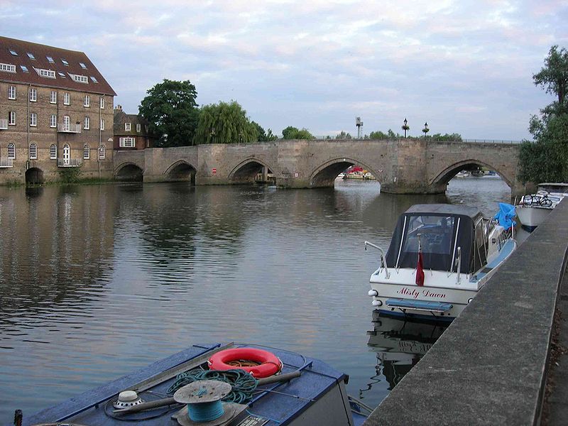
The
Great Ouse is a river in the United Kingdom, the largest and
longest of several British rivers bearing this name. From central
England, the Great Ouse flows into East Anglia before entering
the Wash, a bay of the North Sea. With a course of 143 miles (230
km), mostly flowing north and east, it is the fourth-longest
river in the United Kingdom. The Great Ouse has been historically
important for commercial navigation, and for draining the
low-lying region through which it flows; its best-known tributary
is probably the Cam, which runs through Cambridge. Its lower
course passes through drained wetlands and fens and has been
extensively modified, or channelised, to relieve flooding and
provide a better route for barge traffic. Though the un-modified
river probably changed course regularly after floods, it now
enters the Wash after passing through the port of King's Lynn,
south of its earliest-recorded route to the sea.
***
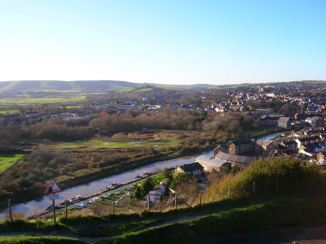
The
River Ouse is a river in the counties of West and East Sussex in
England.
The
river rises near Lower Beeding and runs eastwards into East
Sussex, meandering narrowly and turning slowly southward. A
number of tributaries join it near the village of Isfield, and
more at Barcombe Mills, where it is used by Southern Water along
with neighbouring Barcombe Reservoir, and there are many weirs
and bridges. Just north of this, the Anchor Inn is on the banks
of the river, and canoes can be hired from here. Continuing on
from Barcombe, the Ouse really starts to meander (leaving several
ox-bow lakes) as it reaches Hamsey, where the meander has been
cut short by a canal creating Hamsey Island, home to St. Peter's
Church, which is situated on a mount. Then the river flows
through the town of Lewes, where it has been converted
considerably over history. Three bridges cross it at Lewes:
Willey's Bridge (a small footbridge opened in 1965), the Phoenix
Causeway (a larger road bridge named after the extinct Phoenix
Ironworks), and Cliffe Bridge (which is much older). After Cliffe
the Winterbourne stream flows into the Ouse and the main river is
banked on the west by the Heart of Reeds. The Ouse courses
southeast past Glynde, where the tributary of Glynde Reach gushes
into it; and then passes Rodmell, Southease (where there is a
locally famous bridge) and Piddinghoe, finally reaching Newhaven,
where it splits industrial Denton Island from the mainland and
provides an important harbour in the Port of Newhaven. It then
flows into the English Channel, surrounded on either side by two
long breakwater piers.
This
article is licensed under the GNU
Free Documentation License.
It uses material from the Wikipedia
articles "River_Ouse,_Yorkshire",
"River_Great_Ouse",
and "River_Ouse,_Sussex".
|
|

|